|
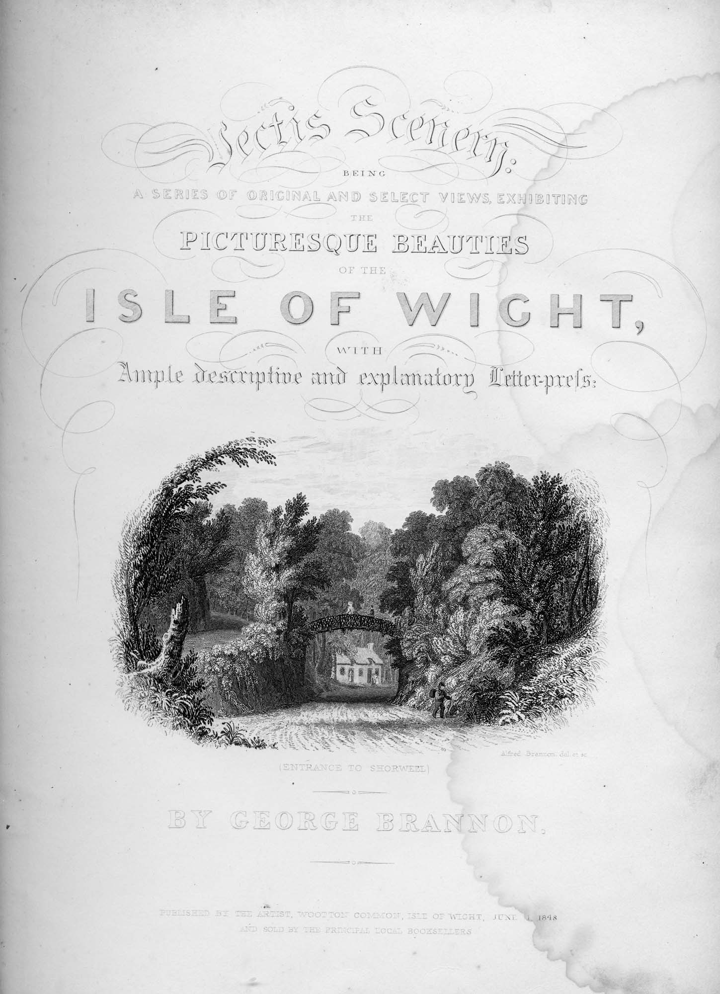
Vignette Entrance to the Village of Shorwell |
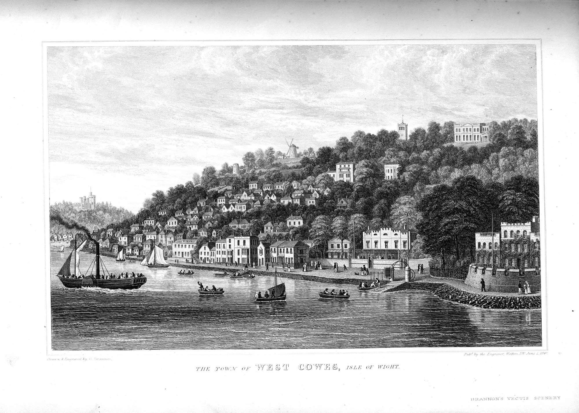 West Cowes, looking towards the harbour and mouth of the Medina River |
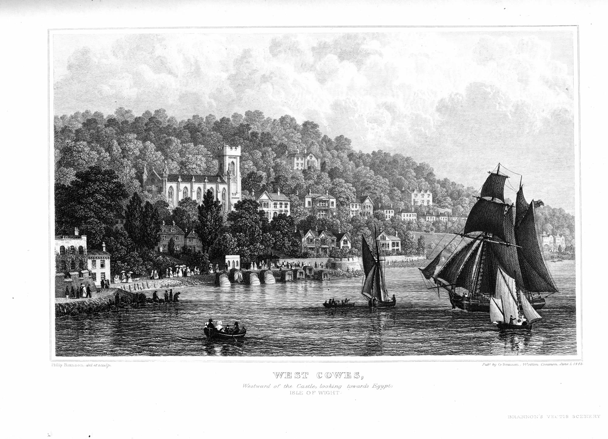 West Cowes westward of the Castle : the new Church &c. |
|
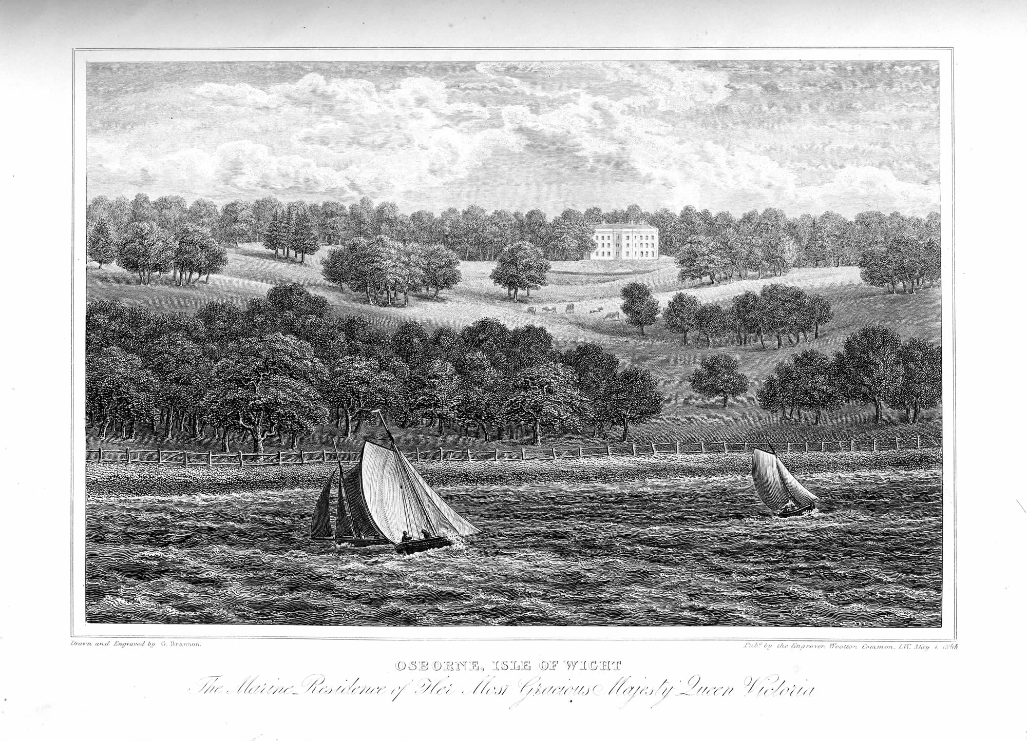
Osborne, the summer-residence of Her Most Gracious Majesty |
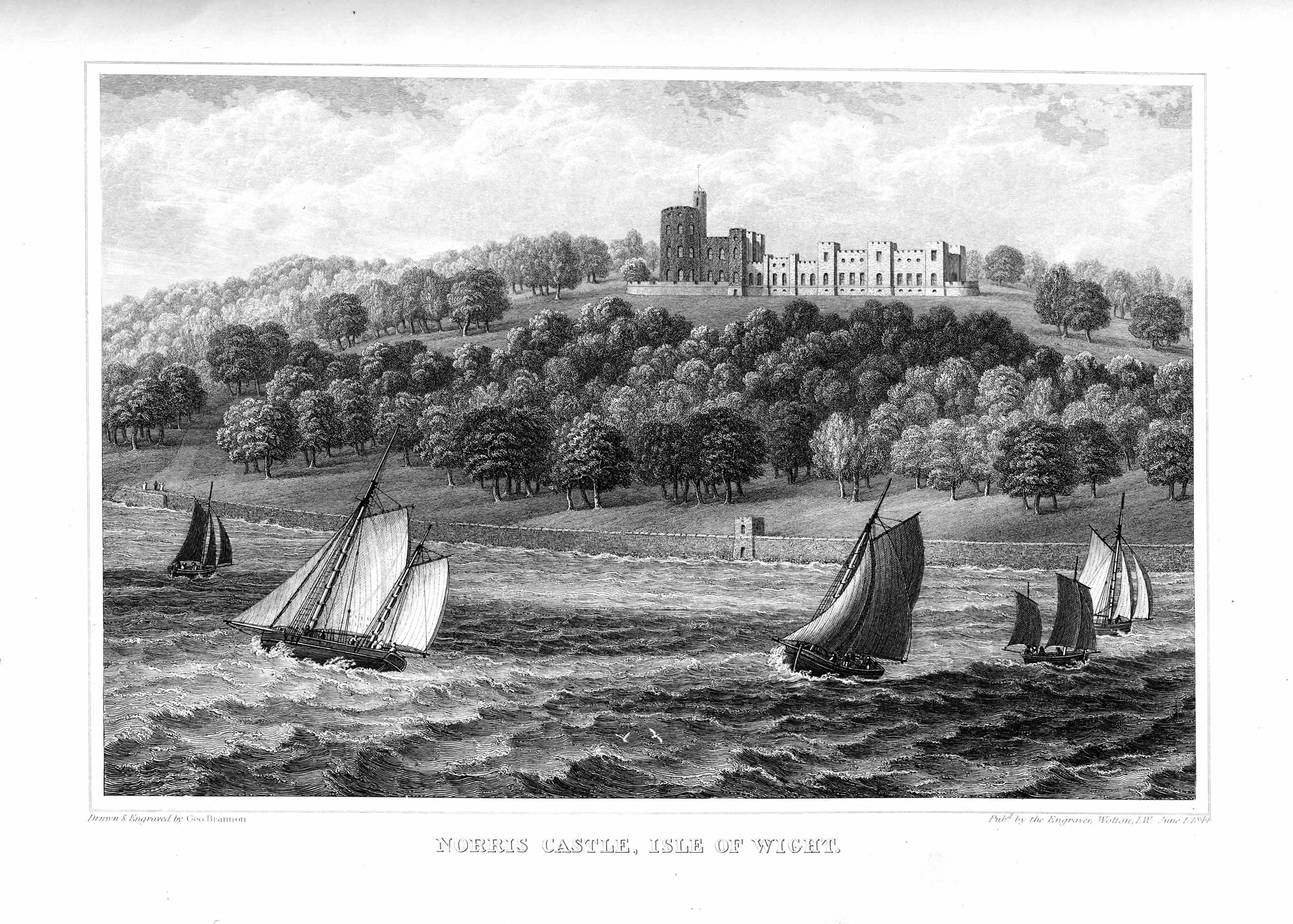
Norris Castle, looking towards Osborne |
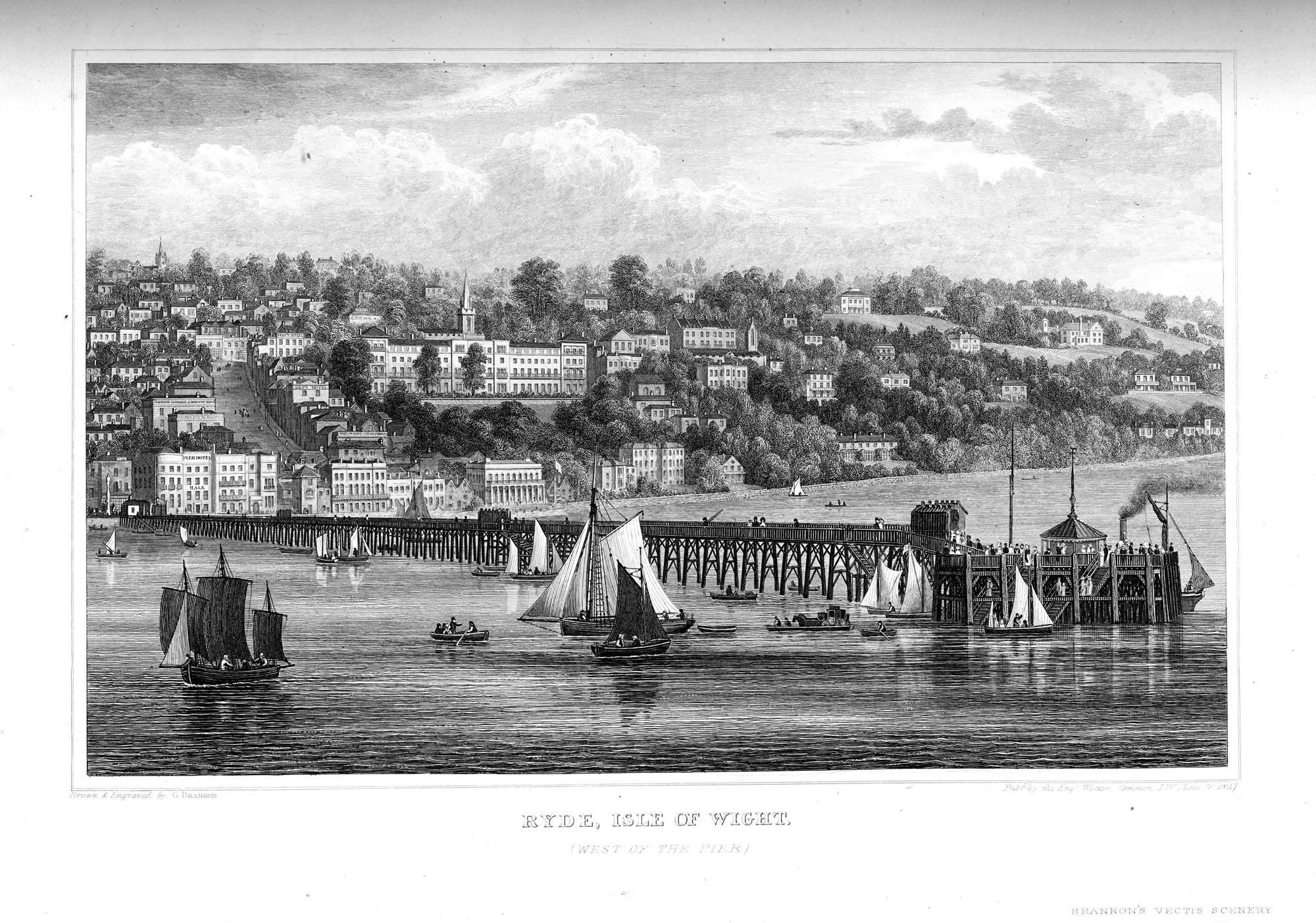 Town of Ryde, and full length View of the Pier. |
|
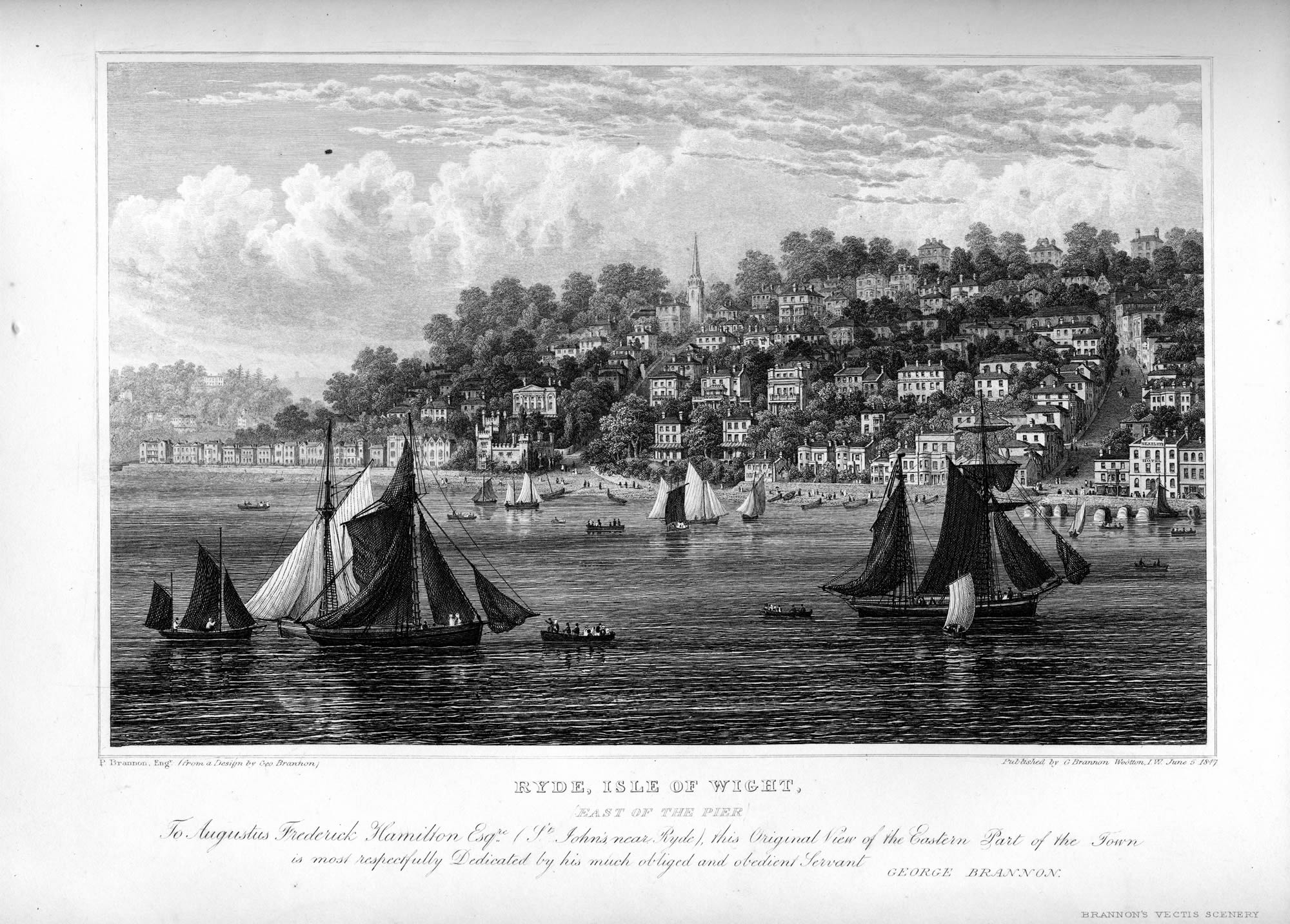
Ryde, eastward of the Pier |
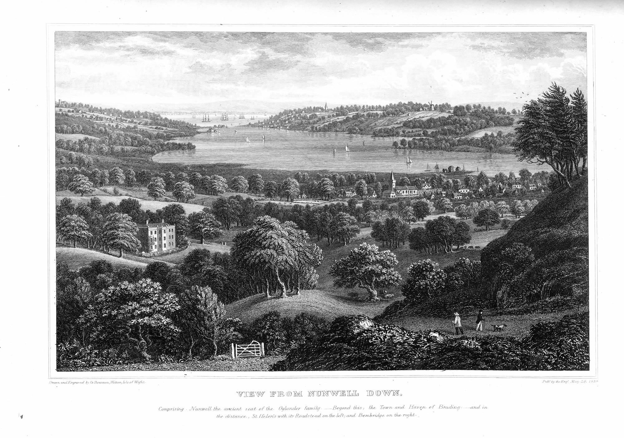 View from Nunwell Down, embracing Brading, Bembridge, &c |
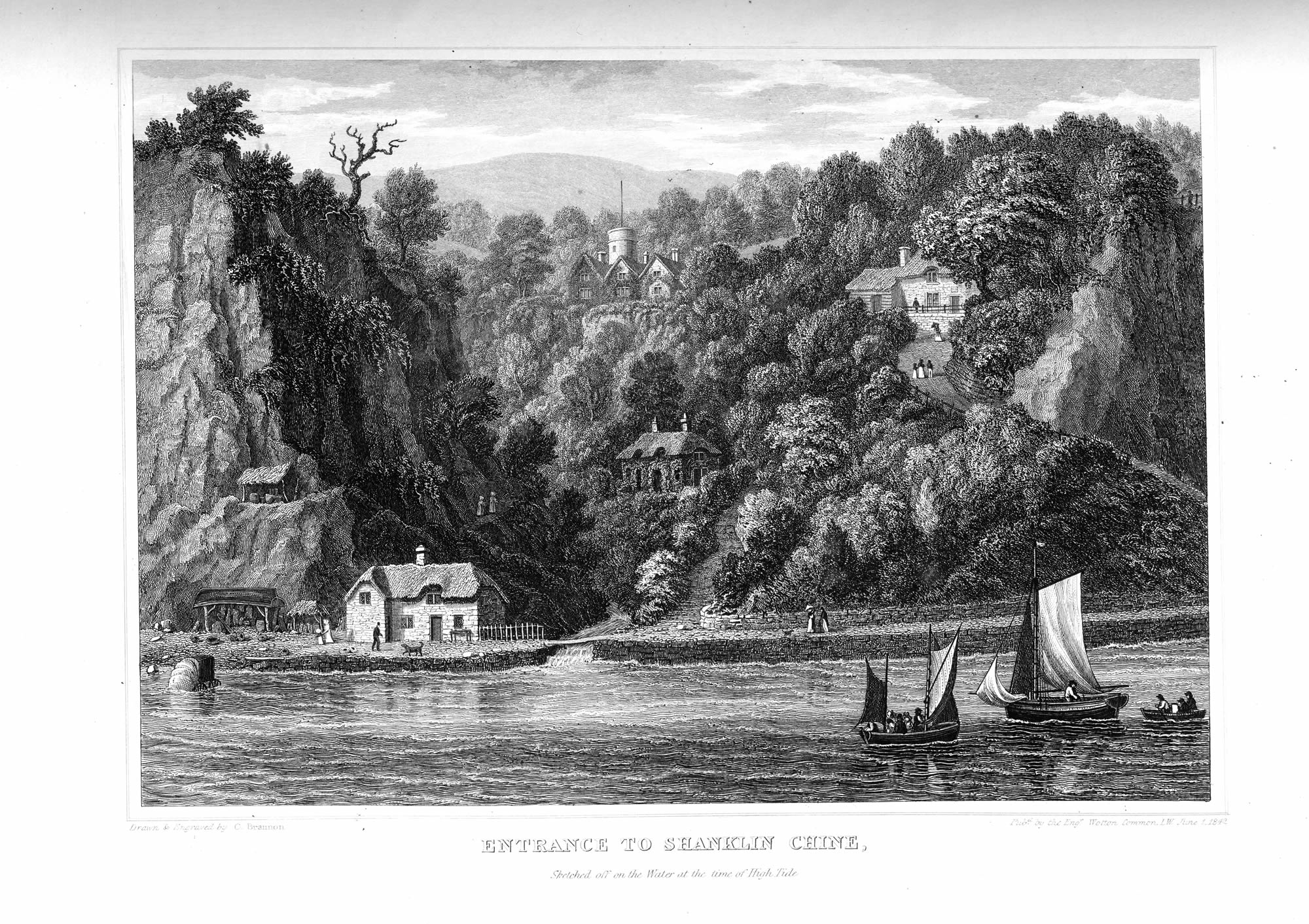 Shanklin Chine, as it appears from off the water at high tide |
|
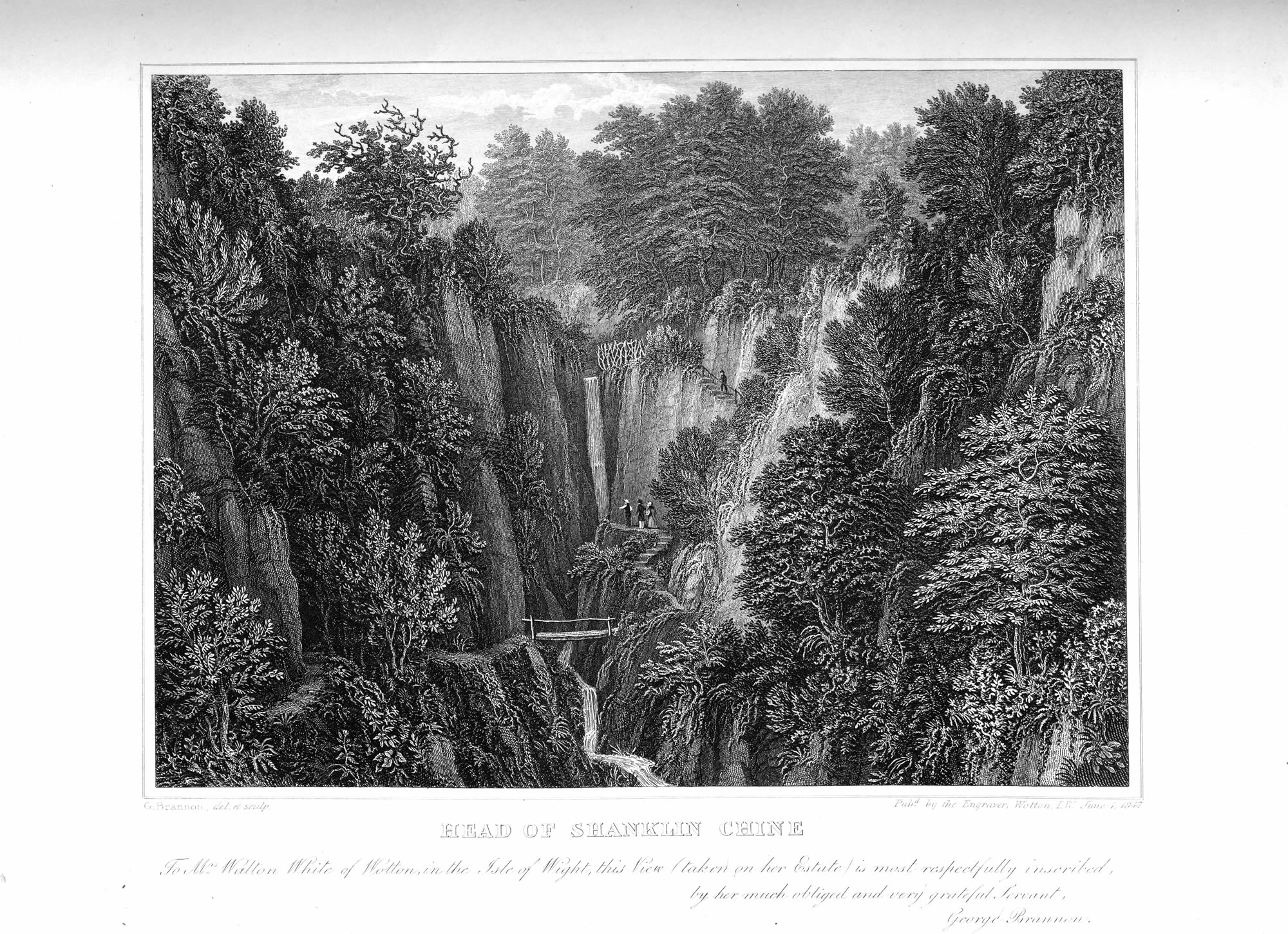
The Head (or waterfall,) of Shanklin Chine |
 View from Shanklin Down, looking over the village to the Culvers, &c |
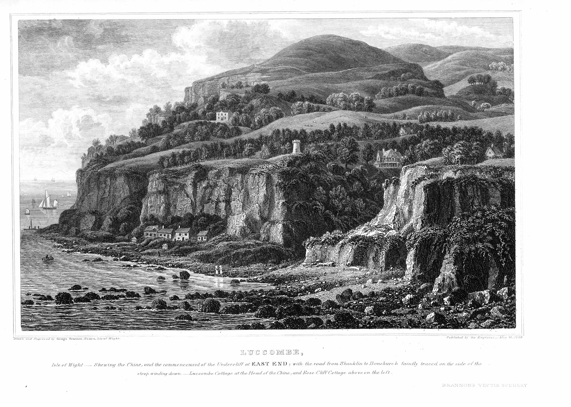 The Chine and Valley of Luccombe |
|
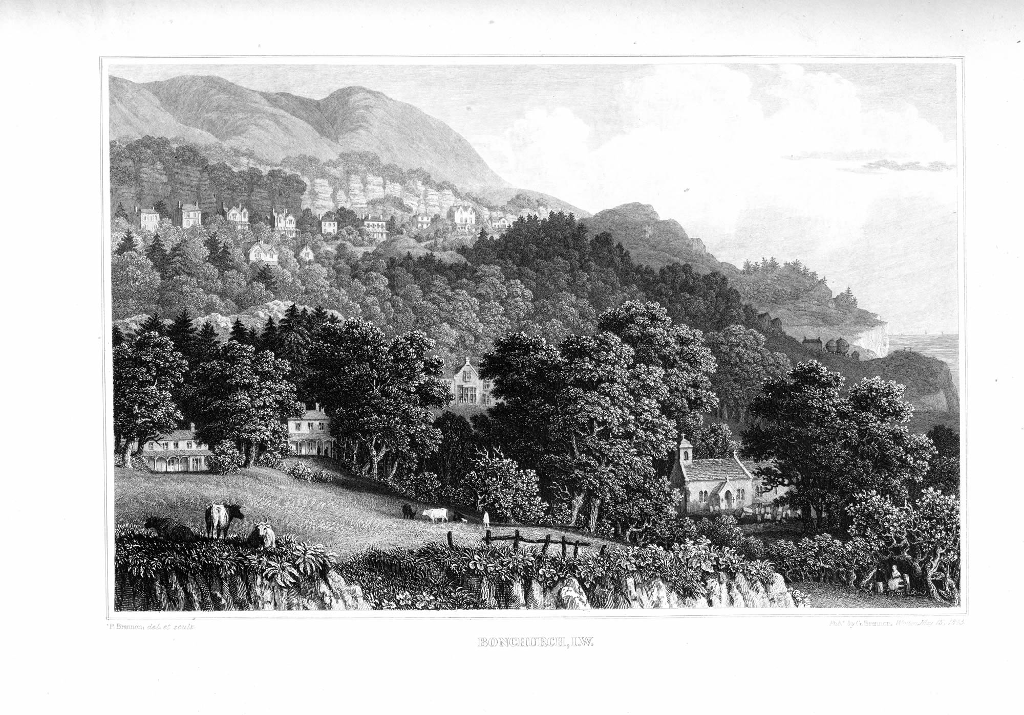
Bonchurch: general view taken from near the old Church |
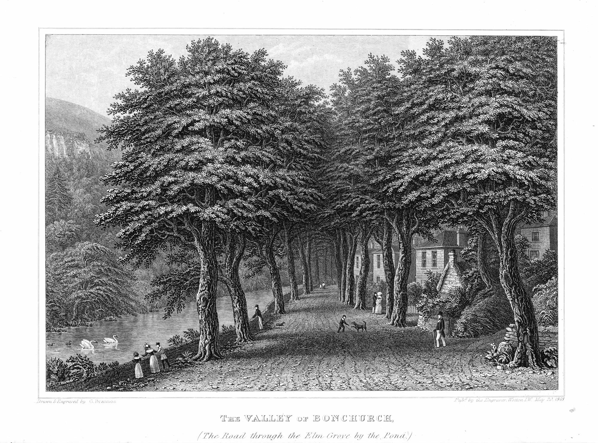 The Valley of Bonchurch: the Road through the elm-grove by the Pond |
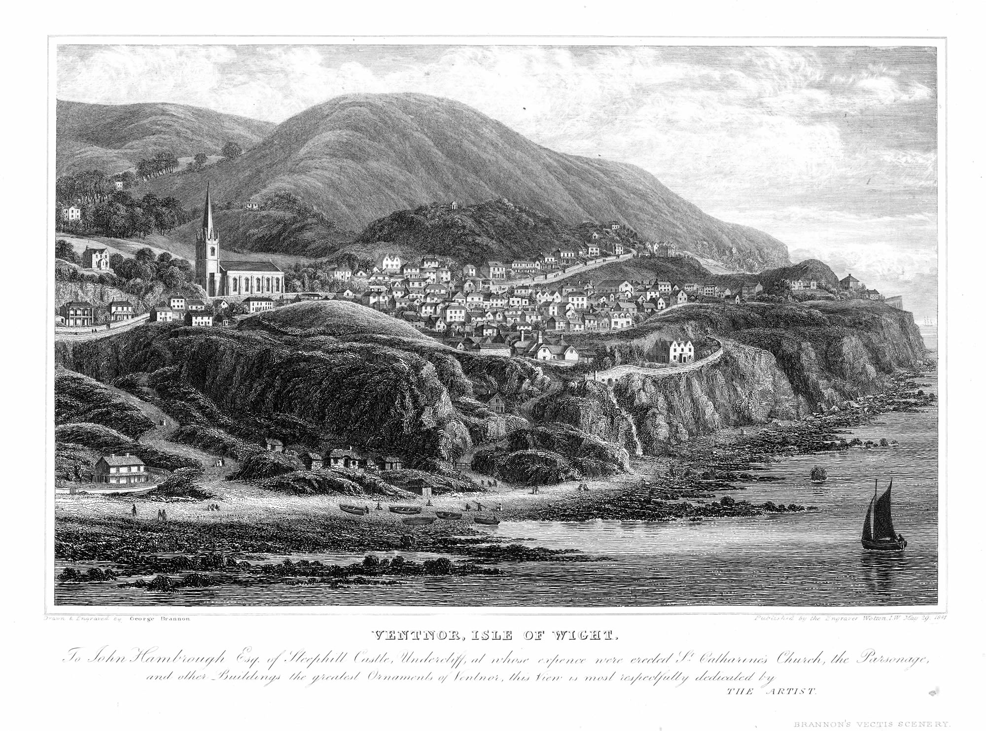 The Town of Ventnor, as seen from the water |
|
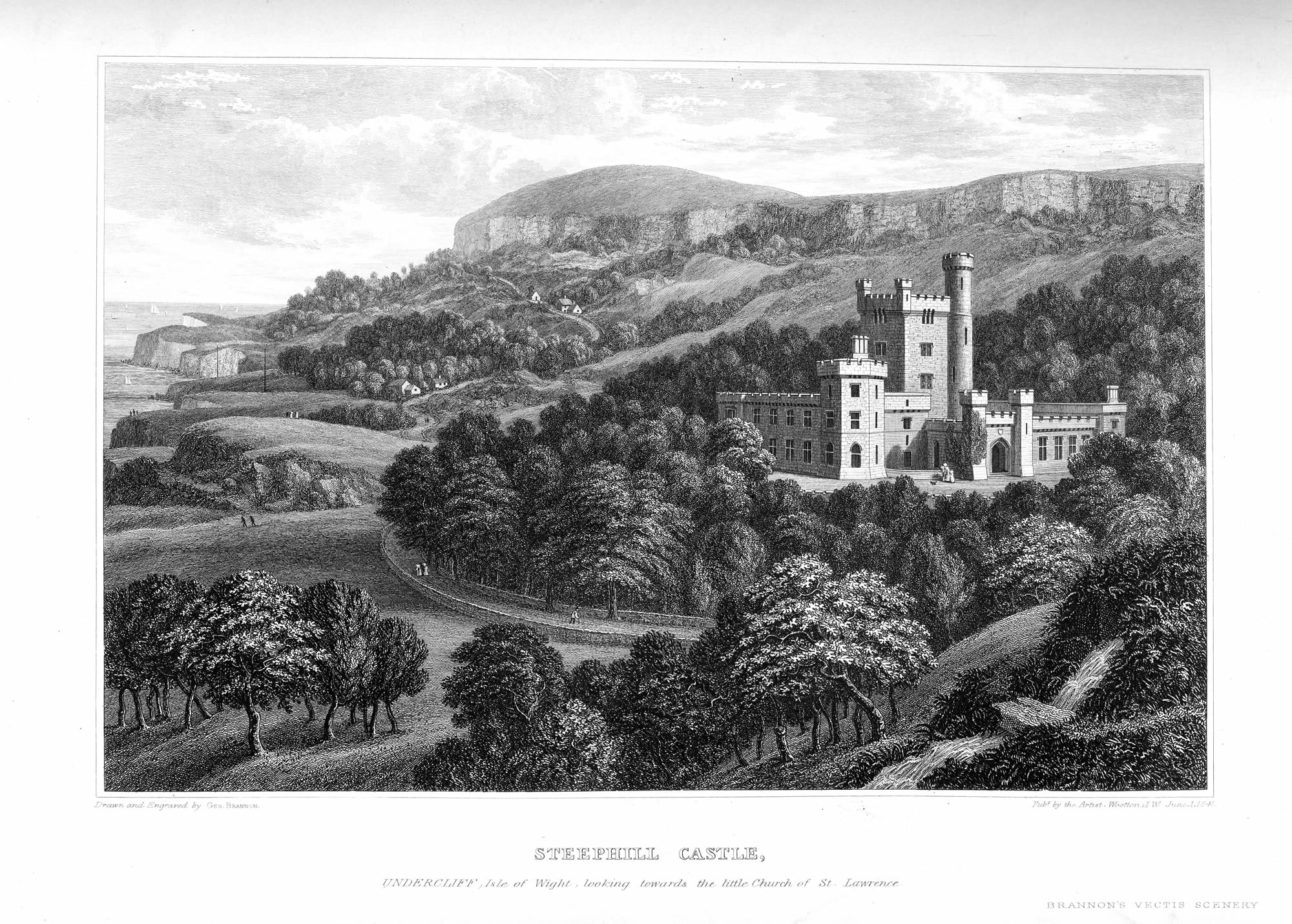
Steephill Castle, the seat of J. Hambrough, esq. |
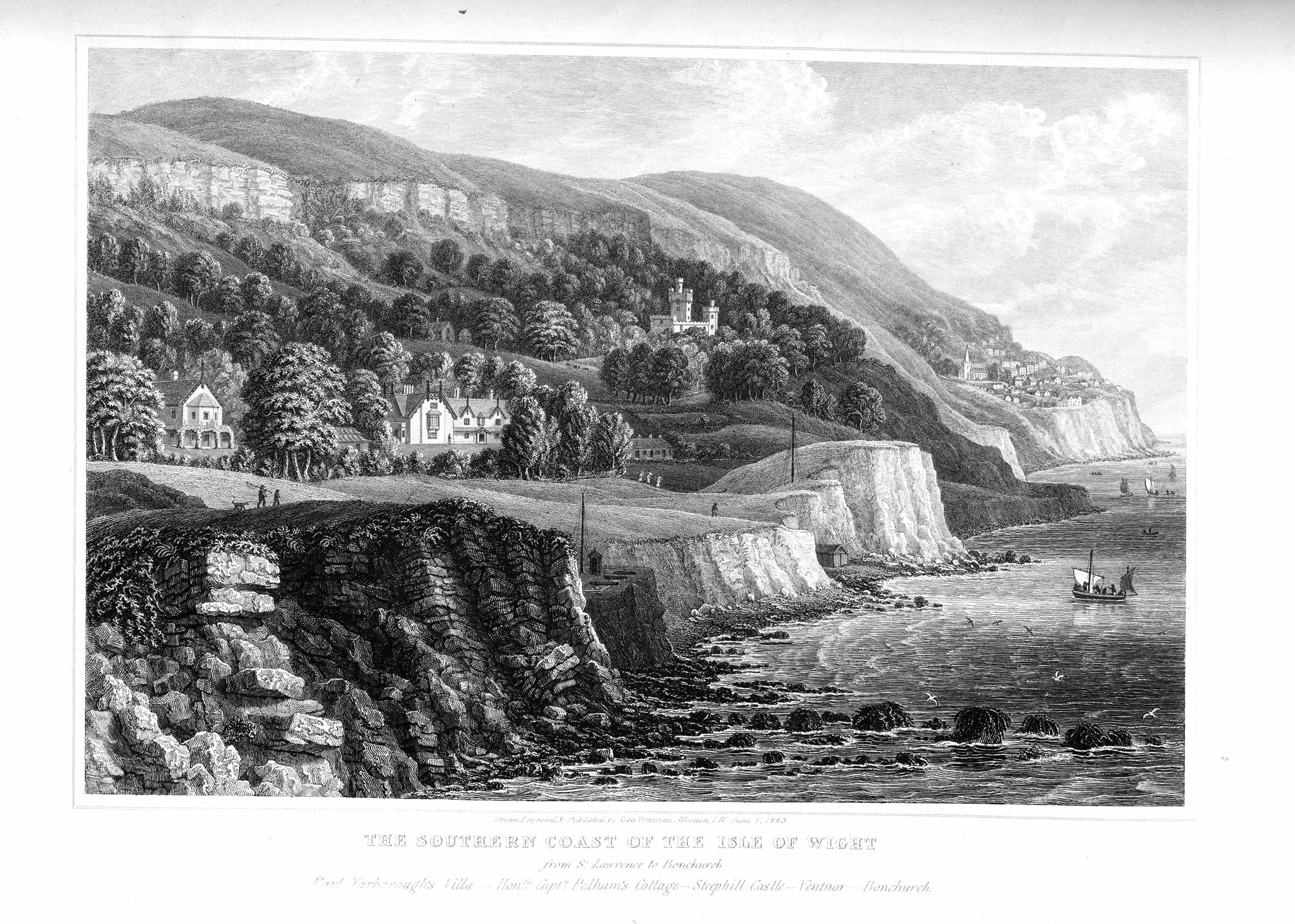 The Southern Coast of the Island, from St. Lawrence to Bonchurch |
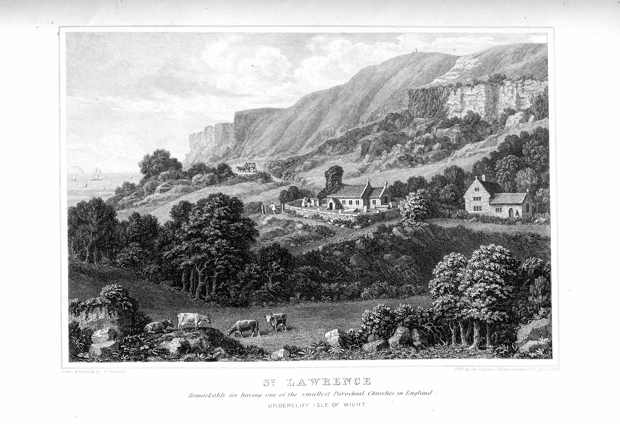 St.Lawrence Church, and the Undercliff looking to the westward |
|
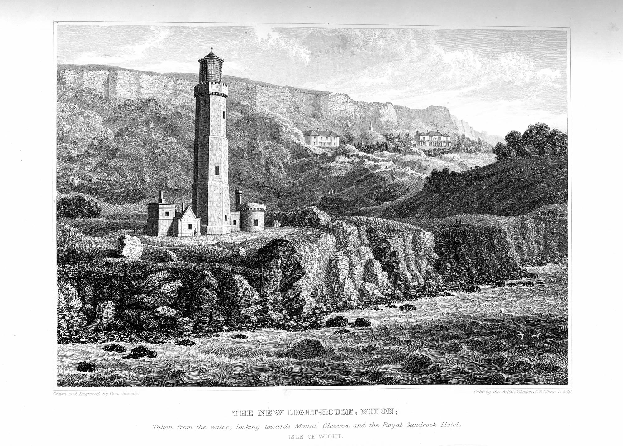
St Catharine's Light-house, near Niton, looking towards Mount Cleeves |
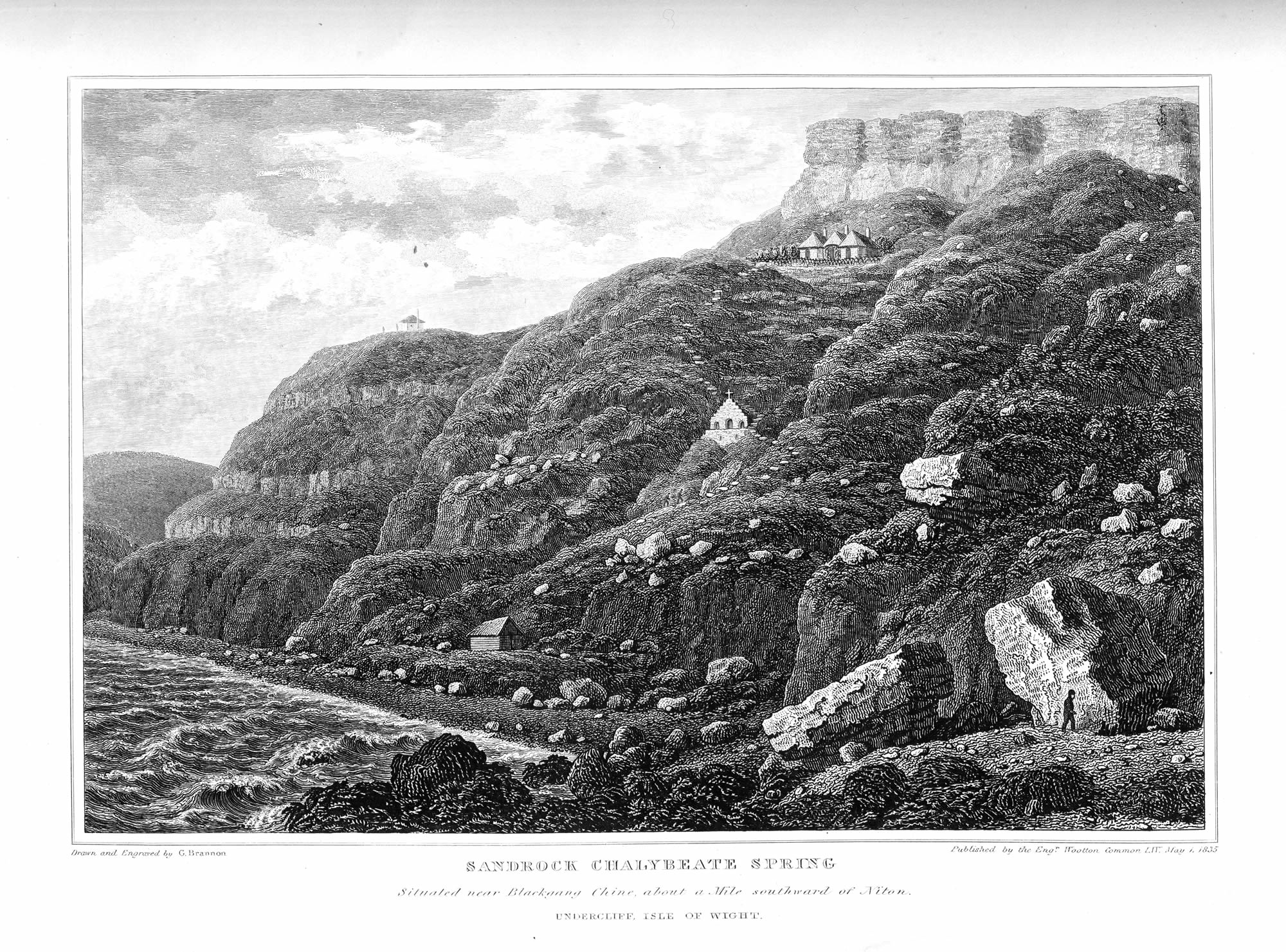 The Sandrock Spring, looking towards Blackgang Chine |
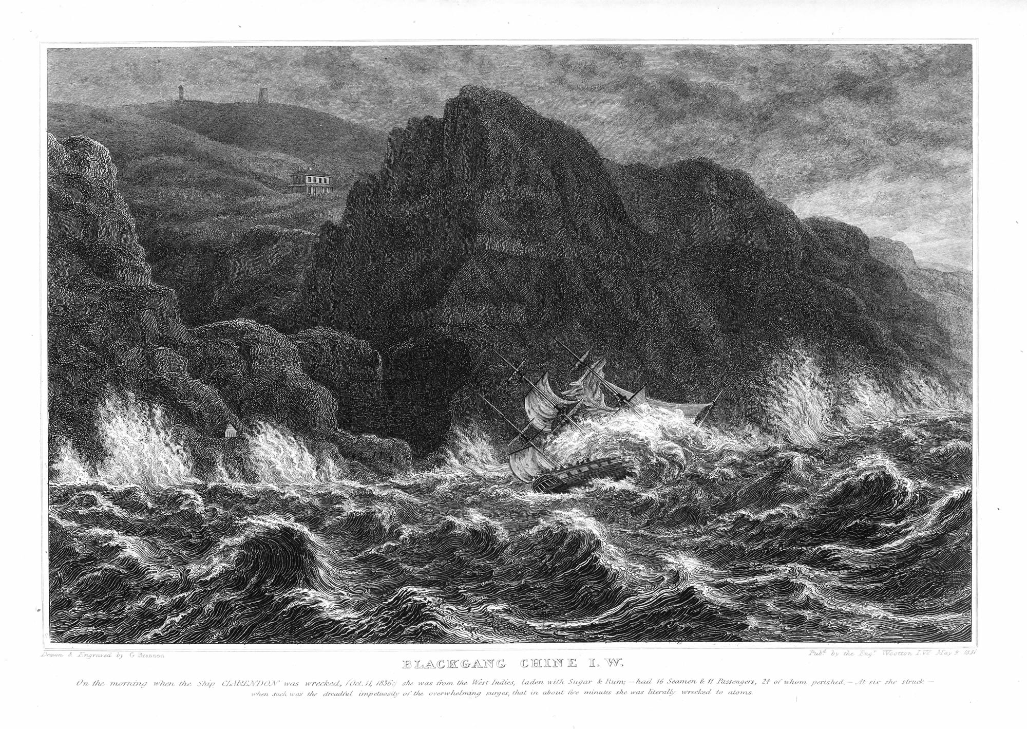 Blackgang Chine, at the time of the wreck of the ship 'Clarendon' |
|
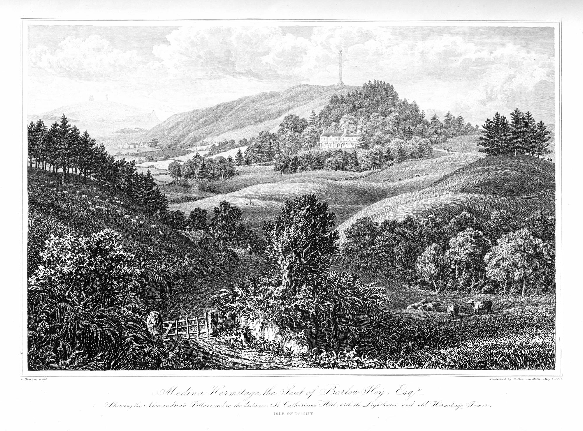
The Medina Hermitage, Alexandrian Pillar &c. |
 Freshwater Bay, from the cliffs, looking towards the beacon |
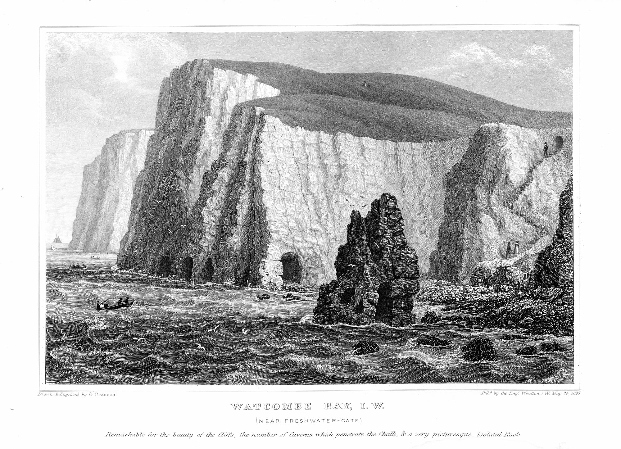 Watcombe Bay: picturesque Rocks, Caverns, &c |
|
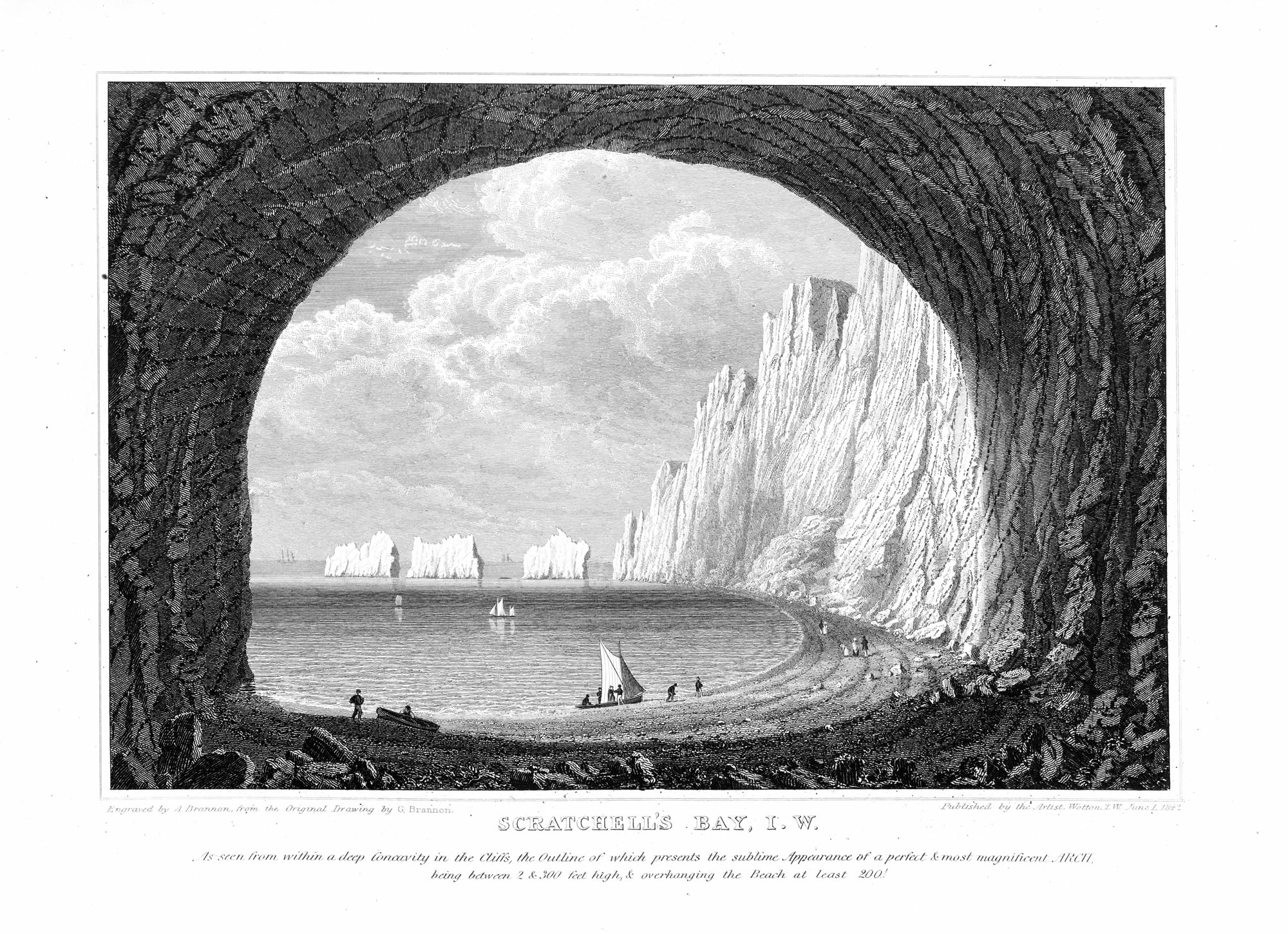
Grand Arch in Scratchell's Bay, from the interior; and the Needles |
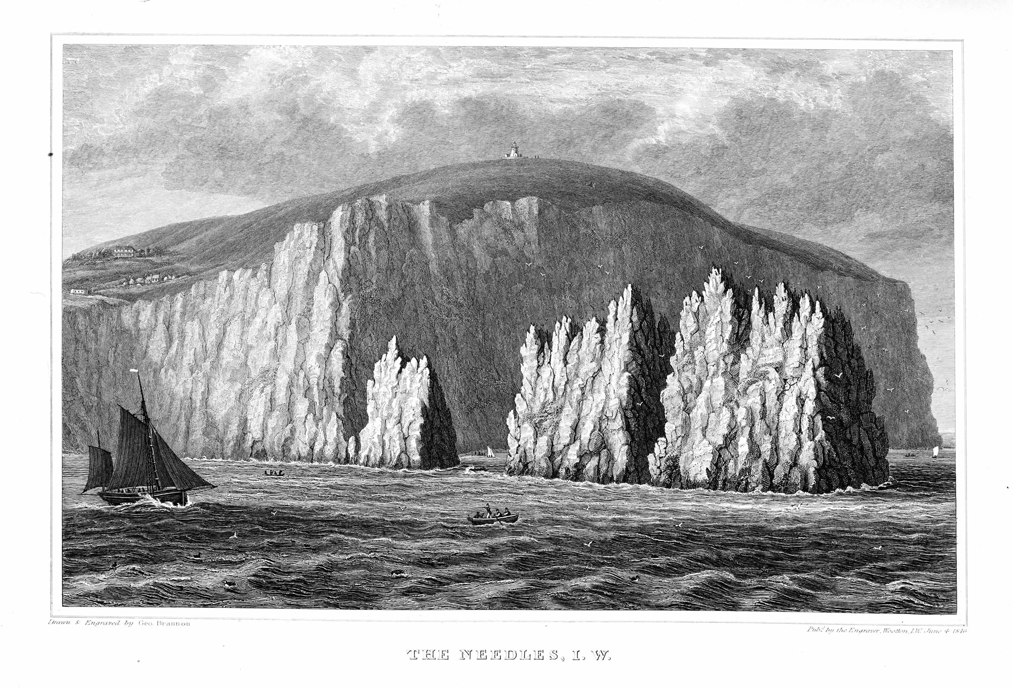 The Needle Rocks, and Lighthouse |
 The Freshwater Cliffs, particularly the Grand Arch in Scatchell's Bay |
|
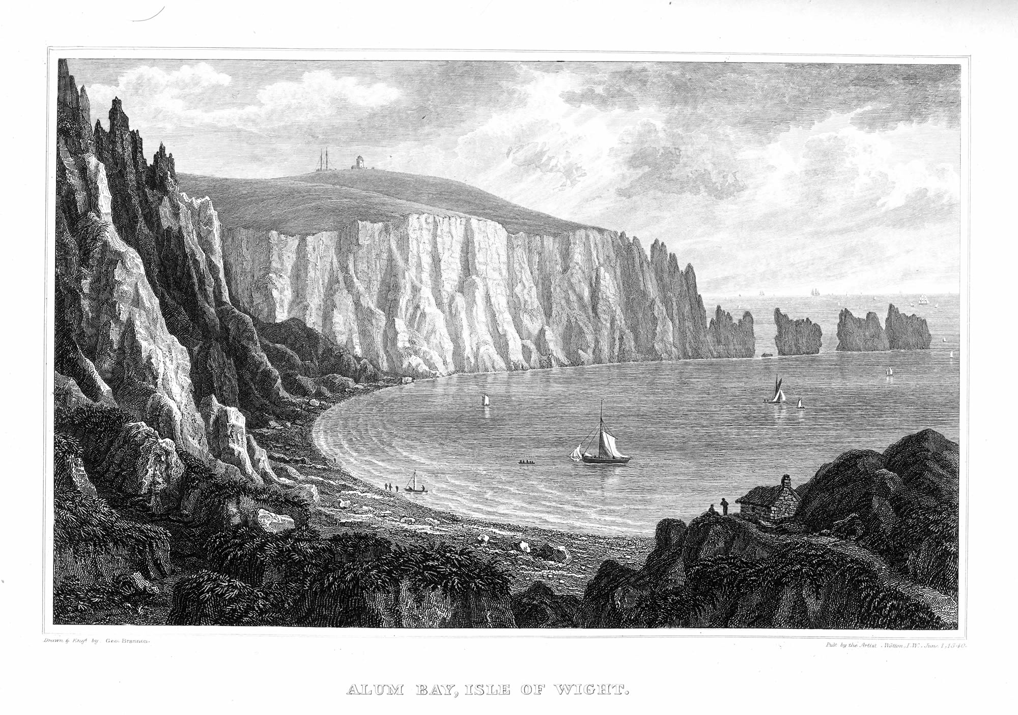
Alum Bay, as it appears from the first descent to the shore |
 The River Yar: Yarmouth on the left - Norton on the right |
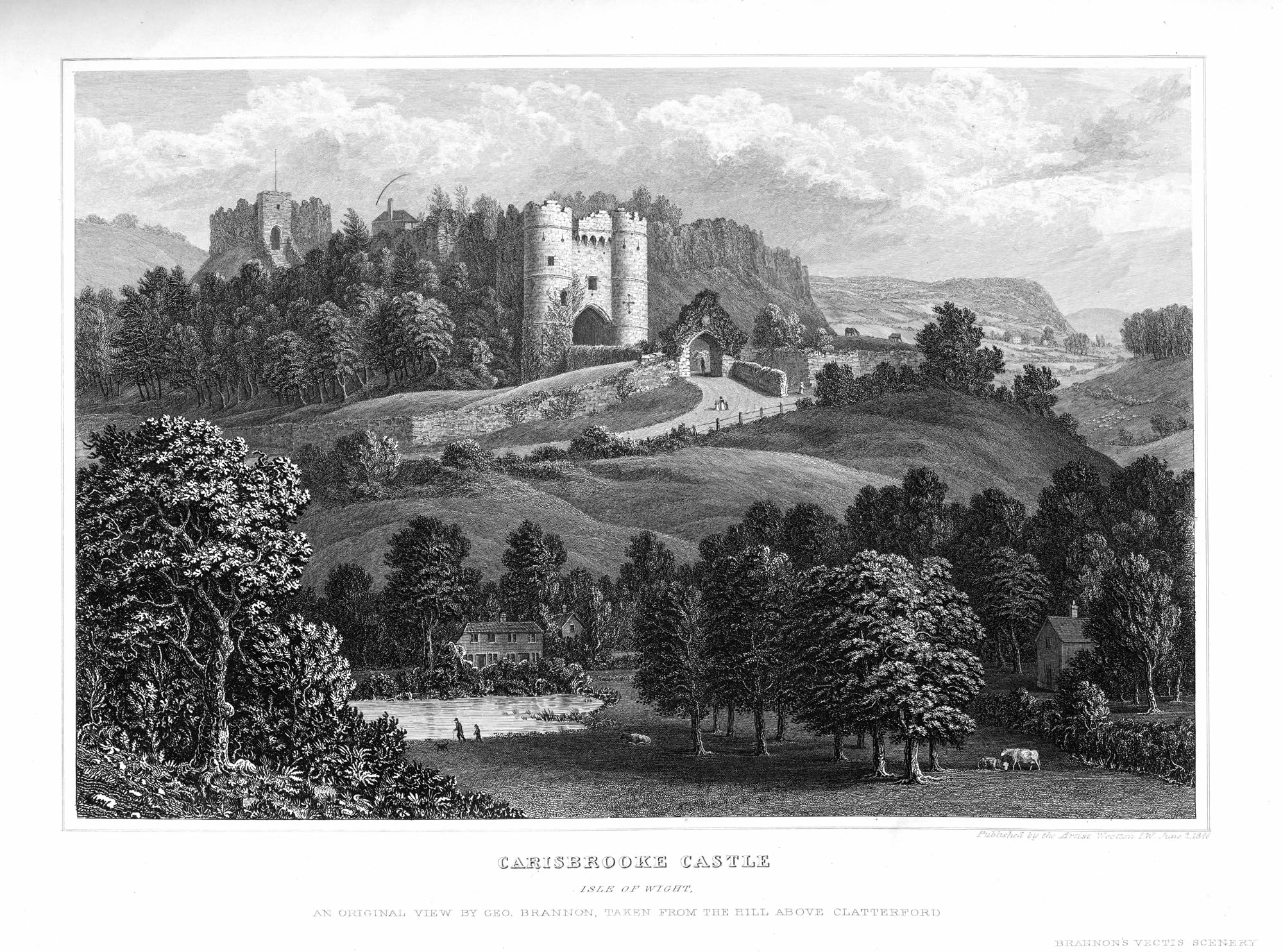 Carisbrooke Castle, and Country to the southward |
|
Carisbrooke Village and Church, as seen from the ascent to the castle |
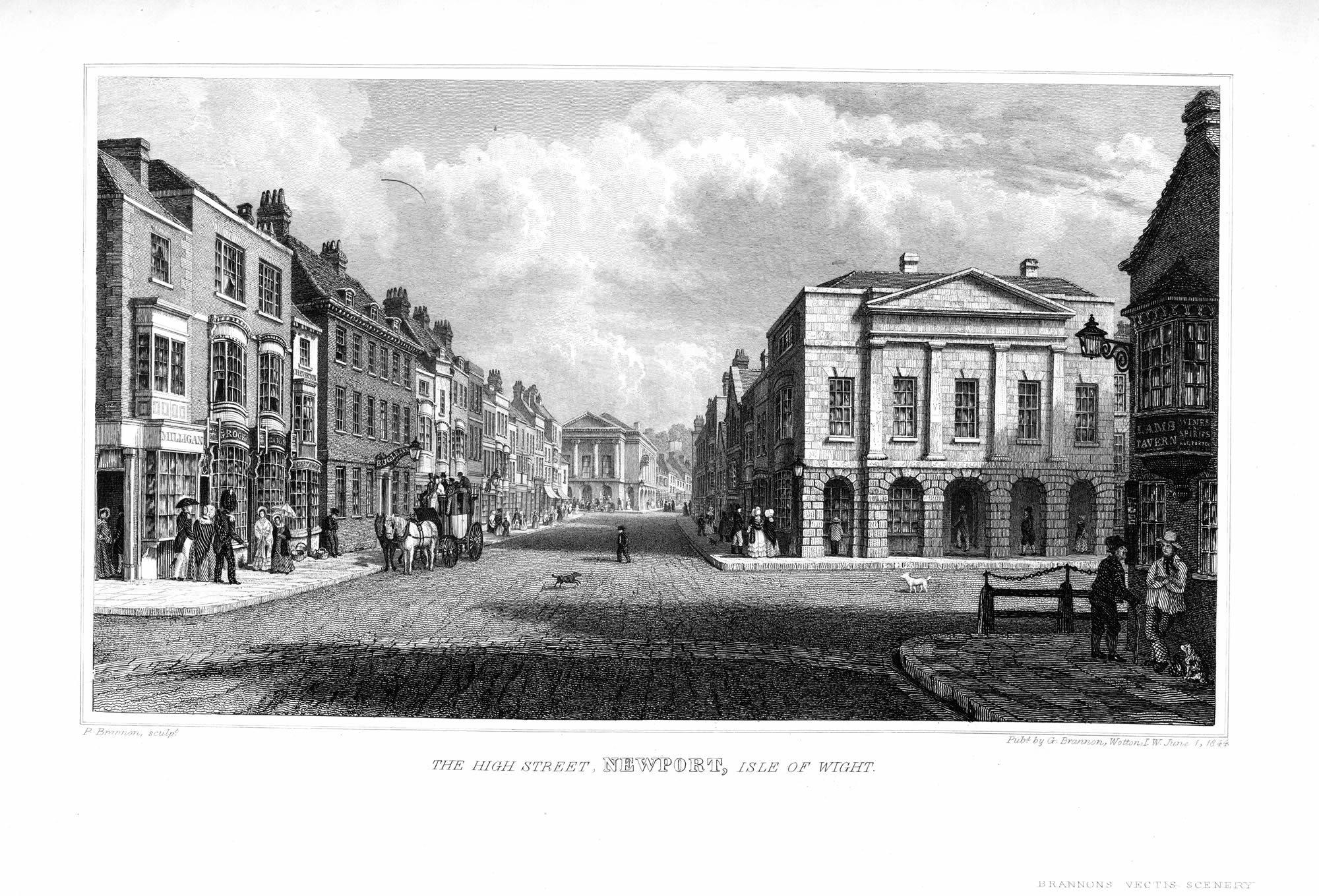 The High-street of Newport; Guildhall, Isle of Wight Institution &c. |
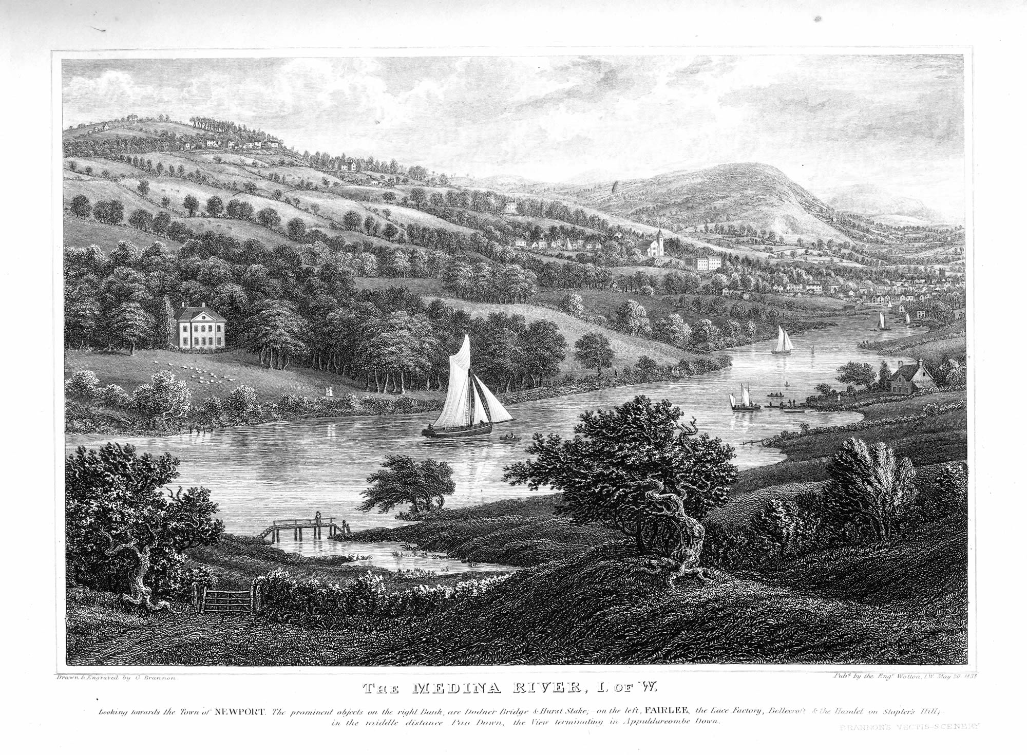 The River Medina, looking towards the town of Newport. |
|
Wootton-bridge, looking over the River and Village to Fernhill |
 Gatcombe, and the Country between Newport and St. Catharine's Hill |
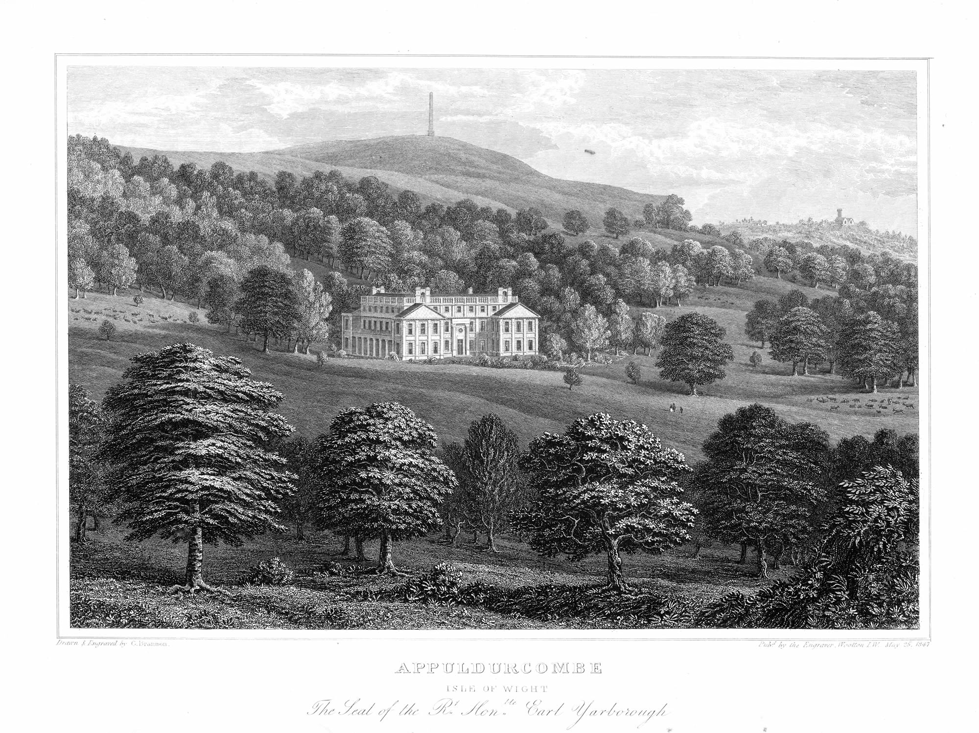 Appuldurcombe, seat of the Right Hon. Earl Yarborough. |
|
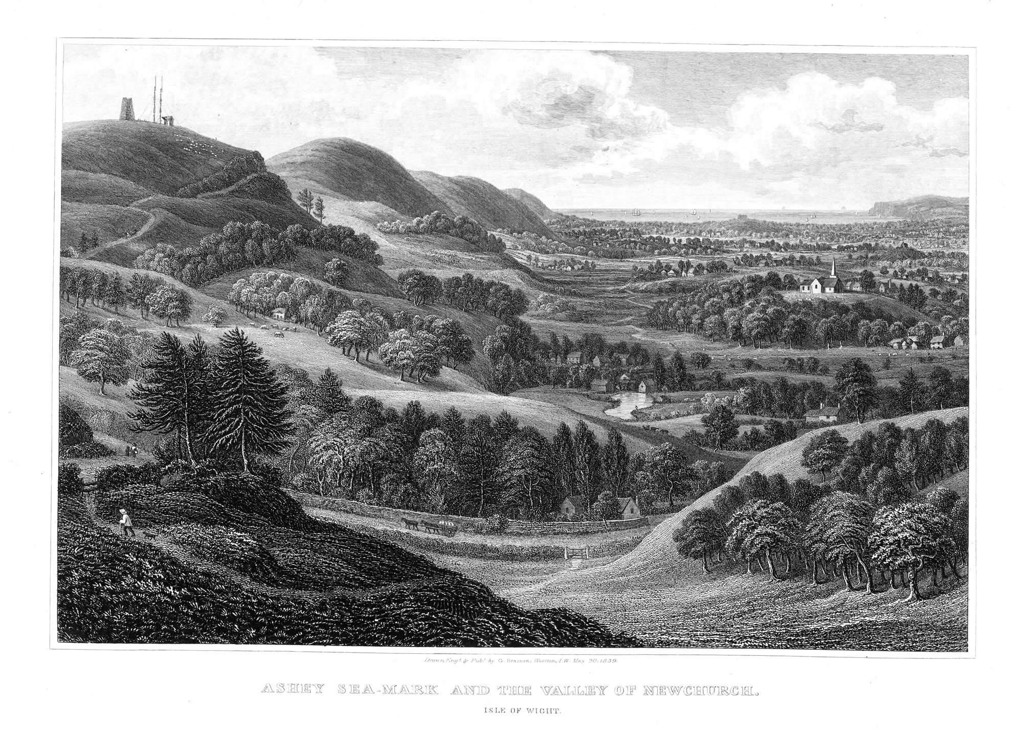
Ashey Sea-mark, and the Valley of Newchurch |
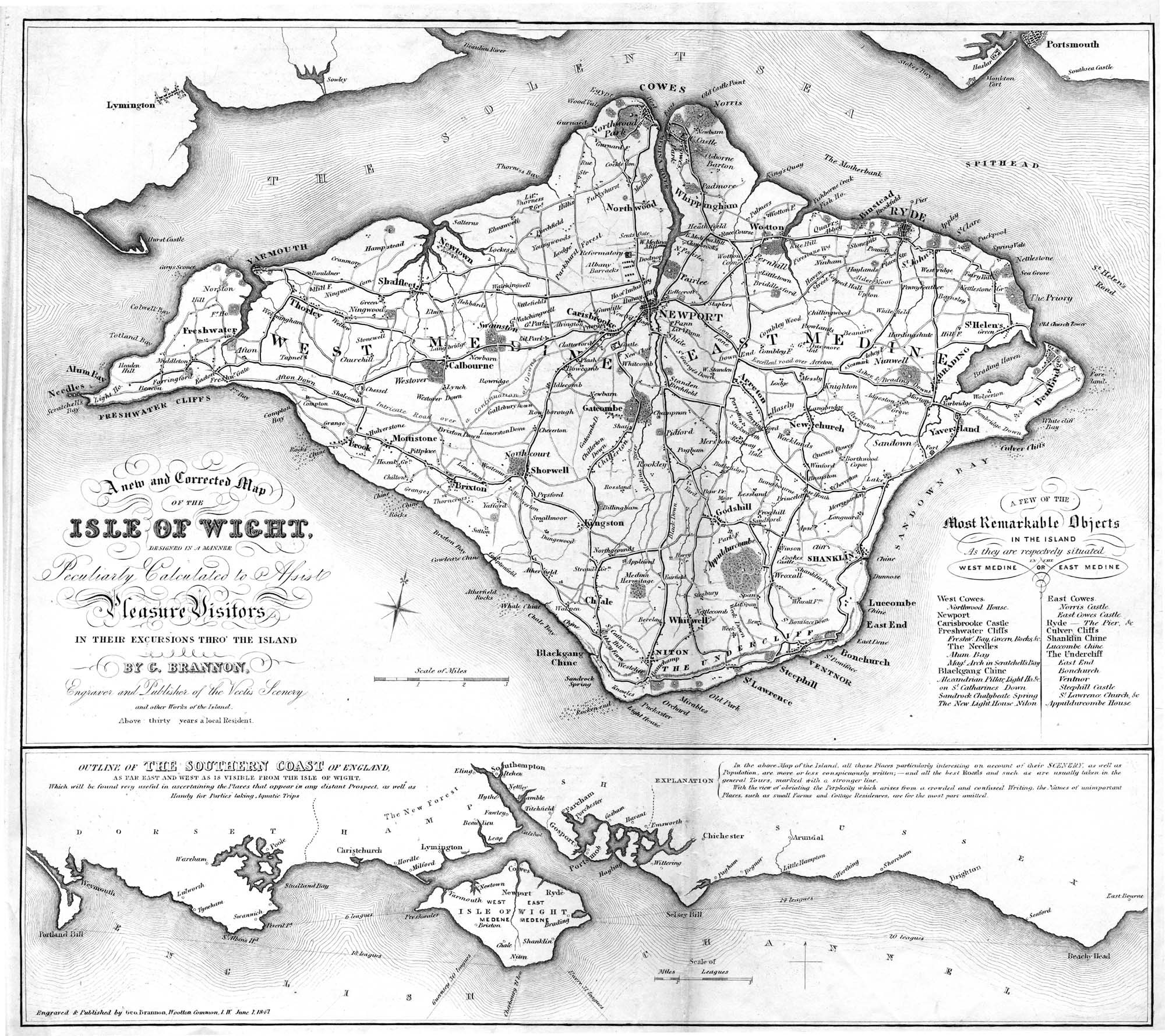
Map of Island from endplates of Vectis Scenery |
|
| |
||